🎉 Your first traffic plan is free, basic event maps are free forever! 🎉
Traffic ChartTraffic Chart

FESTIVAL MAP MAKER, 100% FREE

Draw your festival map in minutes

Drag stages, bars, food trucks, toilets and fencing onto a scaled basemap. The smart zones calculate area in square metres automatically, the routes calculate length in metres. Export a council-ready PDF or share a live URL with your safety team. The event-map module is free for every organiser, forever.

Start your festival map, free

By starting you agree to our terms and privacy policy.

Protected by reCAPTCHA. Google Privacy and Terms.

Trusted across Europe for festival maps:

Client logomih fiber logo RGBpinkpopprofessional lawn & landscape management logo  2solutions30logotransparent
4.9
Google Reviews
4.5
Capterra Reviews

Trusted by 10,000+ event organisers, infra professionals and municipalities drawing a festival map every weekend.

“I've been using Traffic Chart for a while now and loved it from day one. It makes my job in event production a lot easier.”
Emma Brooks, Event Production

01 THE SOLUTION

A festival map drawn to the centimetre

A festival map is the document that everyone on the team works from: production checks the load-in routes, safety checks the emergency exits, the council checks the fence line and the public-zone capacity, the on-site crew checks where each bar and stage goes on the day. When one team draws it in Word or Paint and shares a flat picture, every other team has to interpret. Drawn at the centimetre on a scaled basemap, the same artefact answers every question without a second meeting.

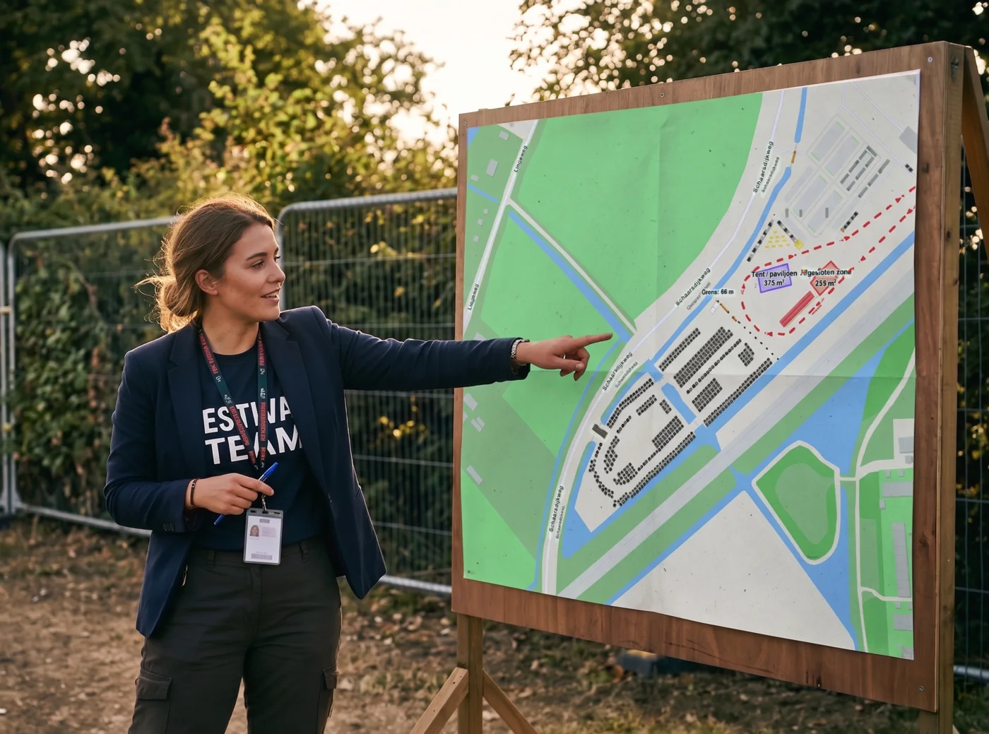
Traffic Chart's event-map module is built for that job. Drop stages, bars, food trucks, ticket booths, fencing and toilets from the catalogue; each item carries its real-world dimensions and snaps to the map. Draw zones as polygons or rectangles with automatic area in square metres. Trace walking routes, vehicle access routes and emergency exits with automatic length in metres. Export an A4 to A0 PDF for the permit application, or share the live link in read-only or edit mode with your safety officer.


Festival map editor on a laptop with stages, bars, food trucks and walking routes drawn on a scaled basemap

Watch our 45 second festival map demo

See an event map and a traffic plan come together in under a minute. Clip from 2025; 10,000+ users today.

Free event-map module: festival site layout with stages, bars and walking routes

02 FREE FOR EVERY ORGANISER

100% free, no card, no paywall

The event-map module is free for every organiser, forever. No trial countdown, no card-on-file, no "register to download" wall. Open the editor, draw your festival map, export the PDF, share the URL. The free tier covers every object in the catalogue, every export format, and unlimited collaborators per event.

We make money on the traffic-plan module, the regulator-facing PDF that some events also need (think road-closure plans for the access road). That side is paid for professional users but the event-site map itself is free, in every country we serve.

Who draws a festival map in Traffic Chart?

Festival producers, community event organisers, infra contractors handling access works, and councils reviewing event applications all use the same editor.

For event organisers

For event organisers

Drawing your venue layout? Filing a road-closure plan for the access road? Build both in the same workspace, with drag-and-drop infrastructure for the event map, smart zones with automatic area, walking and emergency routes, and the full road-sign library when you need it.

Read more
For contractors and infra professionals

For contractors and infra professionals

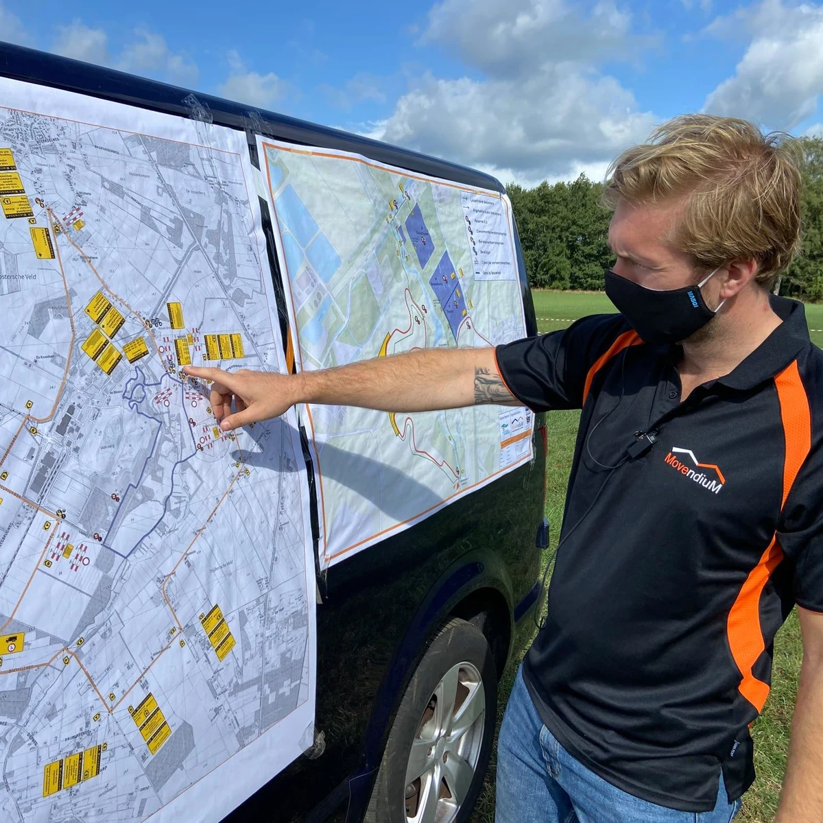
Closing one or two roads (partially) for works? Mandatory traffic plans in minutes. Simple enough for an intern, accurate enough for the council. Running multiple projects a month? The time saved pays back on your first plan.

Read more
For municipalities

For municipalities

Give residents and small-event organisers a friendly tool to draft event maps and traffic plans. Centralise permit intake, cut the email back-and-forth, and review up to 90% faster from a single dashboard.

Read more

Features

  • Drag-and-drop event infrastructure: stages, bars, food trucks, toilets, fencing, ticket booths
  • Zones with automatic area in square metres for parking, camping, public, restricted
  • Walking routes, vehicle routes and emergency exits with automatic length in metres
  • Scaled basemap with the real event site, not a sketch
  • Export PDF A4 through A0 for the permit application
  • Live share URL with view-only or edit access for the safety team

Benefits

  • Free forever, no card, no paywall, no trial countdown
  • Whole festival drawn in an afternoon, not a week
  • Same drawing serves production, safety, the council and the crew
  • Drop a bar, drop a stage; no CAD, no Photoshop, no training
  • Recurring events: duplicate last year's plan in one click
  • Permit reviewers recognise the export format on first read
Traffic Chart event-map module replaces Word, PDF, Paint, Photoshop, CorelDraw and CAD for festival site planningREPLACESWWORDPDFPDFPPAINTPsPHOTOSHOPCdCORELDRAWCADCADAll-in-one with Traffic Chart

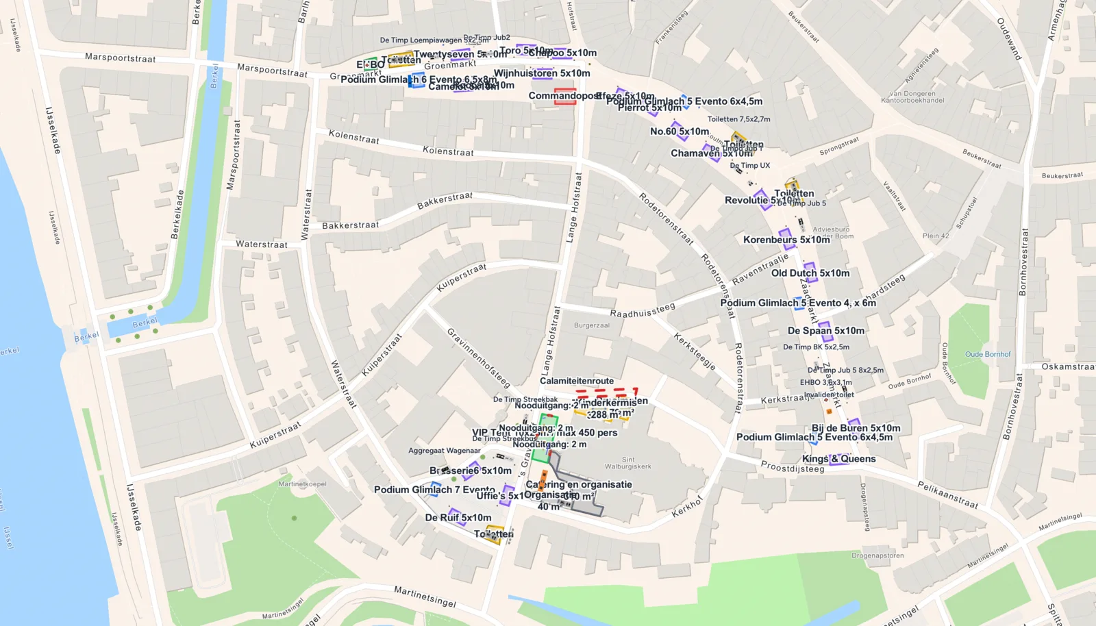
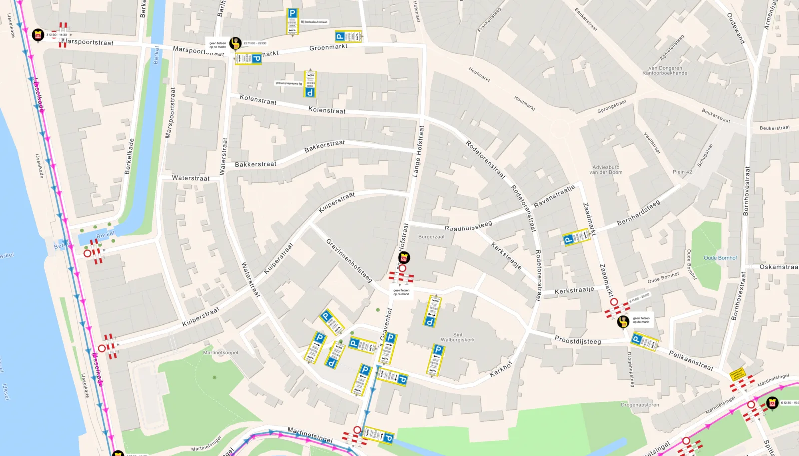
Same event, two views

Left: the traffic plan for the access road. Right: the festival map of the event site.

Festival map reviews from event organisers

10,000+ event teams use Traffic Chart to draw the festival site. Here is what a few of them say about the event-map module.

4.9/ 5 (11 reviews)
5.0

“Tents, bars, stages, the camping area, every walking route, every emergency exit. Drag, drop on the map, done. The council got a PDF in a format they recognised on the first try.”

Emma Davies, Festival producer, Bristol

Frequently asked questions

Everything organisers ask before drawing their first festival map.

Is the festival map module really free?
Yes, free for everyone, forever. Every object in the catalogue, every export format, unlimited collaborators per event. No card on file, no trial countdown. The paid side of the product is the traffic-plan module, the regulator-facing PDF for road-closure plans, separate from the event-site map.
Can I export the festival map as a PDF for the council?
Yes. A4, A3, A2, A1 or A0, portrait or landscape. The export includes the basemap, every object, every zone with its m² label, every route with its metre label, plus a legend. Most councils accept the PDF as-is for permit submission.
Do I need CAD experience to draw a festival map?
No. The editor is a browser canvas with a drag-and-drop catalogue. Drop a stage, draw a polygon for the camping area, trace a route for the emergency exit. No CAD, no Photoshop, no training. Most organisers draw their first festival in 40 to 60 minutes.
Can my safety officer review the festival map without an account?
Yes. Generate a share URL in view-only mode and send it. They open it in any browser, no account needed. If they need to leave comments or edit, switch the URL to edit mode and they can.
I run the same festival every year. Can I reuse last year's map?
Duplicate it in one click. Adjust the stages or fencing for this year's edition, re-export the PDF, share the new URL. Most recurring organisers spend more time on the duplicate dialog than on this year's map.
How is the basemap drawn to scale?
The editor pulls a real-world basemap (OpenStreetMap by default) so when you drop a 12-metre stage, it covers 12 metres of the actual ground. Polygons calculate area against the basemap projection, so a 1,200 m² camping zone is a 1,200 m² camping zone in the field.
What if I also need a traffic plan for the access road?
Open a traffic-plan in the same workspace. The two modules share the basemap and the catalogue, so the event-site map and the road-closure plan stay in sync. Traffic plans are paid for professional users; your first plan is free.