
FOR INFRA PROFESSIONALS
Permit-ready traffic plans in minutes
Drag a traffic sign onto the map, draw the closure, trace the detour. Lengths and areas are calculated for you. Export the PDF your council accepts on the first read. No CAD, no Photoshop, no training.
Your first traffic plan is free. After that it runs on a yearly subscription. Filing more than 50 plans a year? Talk to us for custom pricing. The form on the right is the channel for that.
“Bulk-placement turned a half-afternoon click-job into 30 seconds.”
“Duplicate last week's plan, change the dates, ten minutes instead of an hour.”
50+ plans a year? Talk to us
It's not just professionals that love us:





Over 10,000 professionals from the event industry, infrastructure industry and municipalities use our software daily.
“I've been using Traffic Chart for a while now and loved it from day one. It makes my job in event production a lot easier.”
01 TRAFFIC PLAN MODULE
Drag, draw, file. That's the workflow.
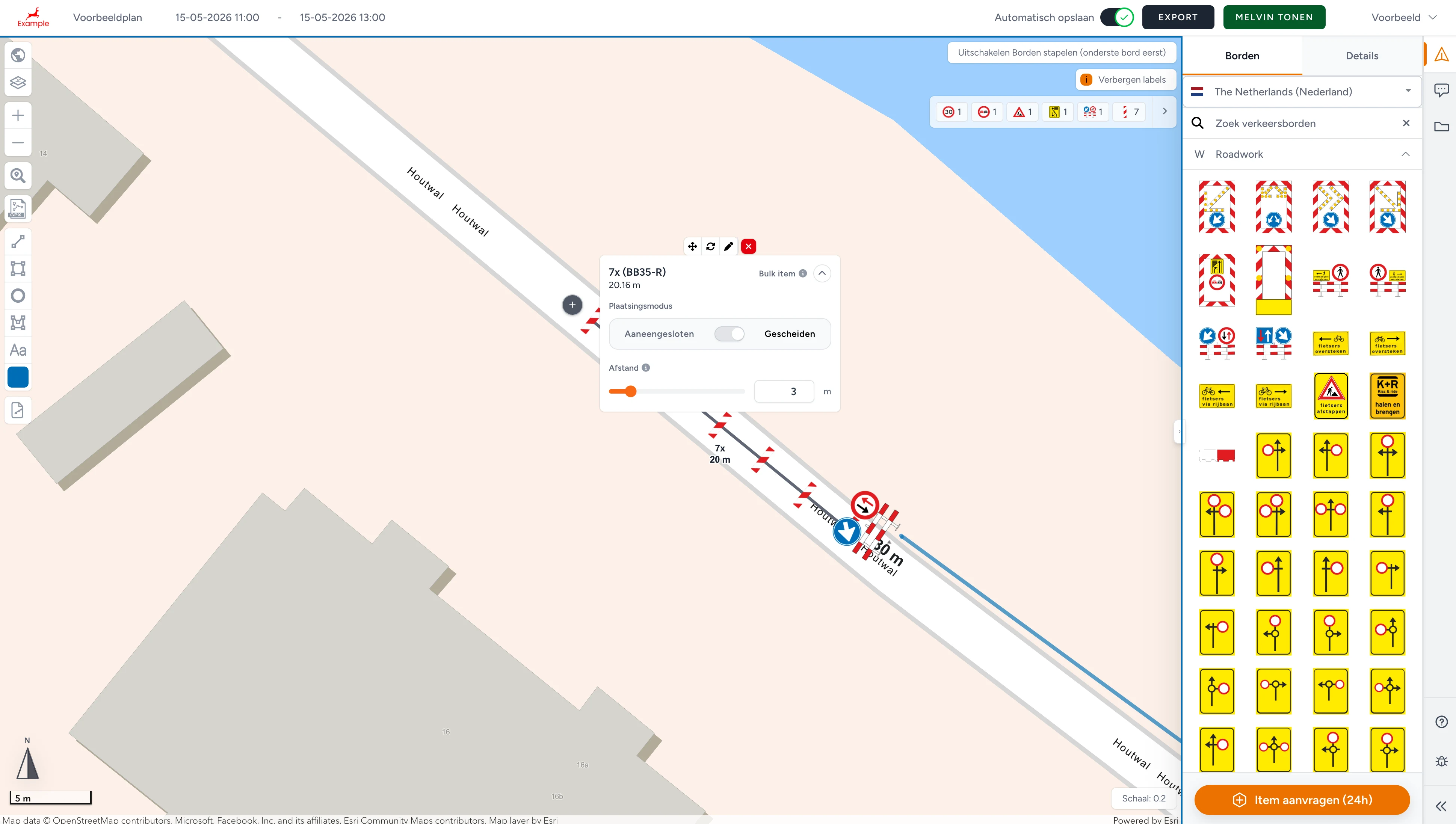
Open the editor in any browser, pan to your worksite on the map, and start placing signs from the country's official catalogue: RVV (NL), StVO + RSA (DE), TSRGD + Chapter 8 (UK), DGT Norma 8.3-IC (ES), IISR (FR), the Portuguese Manual de Sinalização Temporária. Every sign carries its real-world dimensions and lands on the map at scale.
Draw the closure as a polygon, a narrowed lane as a rectangle, the workspace as a circle. Areas are calculated in m² automatically. Trace pedestrian, vehicle and emergency-access detours; lengths come along. Export as A4 / A3 / A2 / A1 / A0 PDF for permit submission, or share the live URL with your foreman, safety officer and the council reviewer.

How you draw a traffic plan
Nine steps from a blank map to a PDF the council recognises on first read.
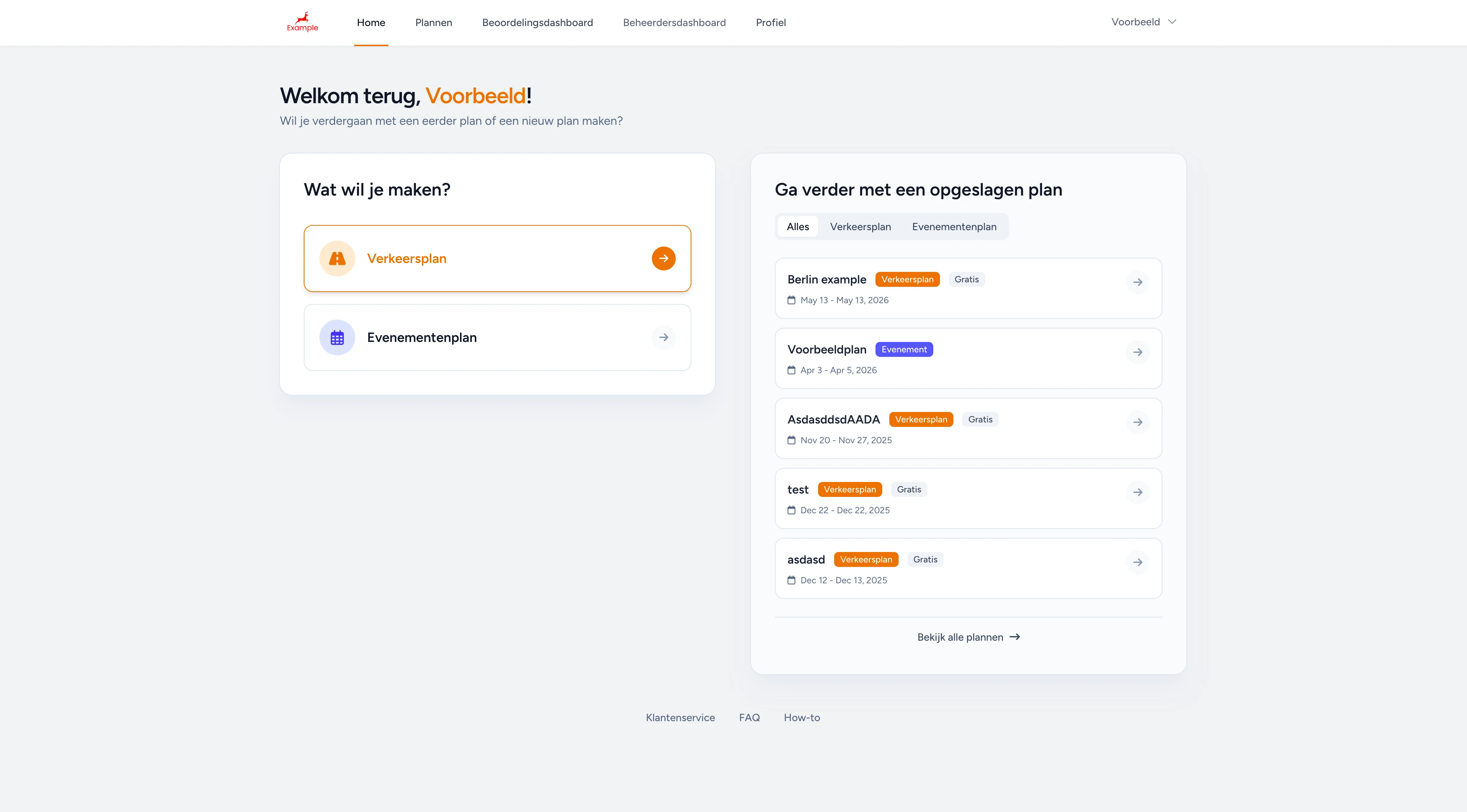
Choose 'Traffic plan' at login
After login you pick what you're drawing today, a traffic plan or an event map. Each is its own module with its own catalogue. Saved plans surface on the right so you can pick up where you left off.
Features
- Country-specific sign catalogues: RVV (NL), StVO + RSA (DE), TSRGD + Chapter 8 (UK), DGT Norma 8.3-IC (ES), IISR (FR), Manual de Sinalização Temporária (PT)
- Bulk-placement of a whole row of approach signs at the right spacing (Pro)
- Duplicate plans in one click, perfect for recurring closures on similar road stretches
- Polygon, rectangle and circle zones with colour picker, auto-measured in m²
- Detour, vehicle, pedestrian and emergency-access routes with auto-measured length
- Live Melvin overlay (NL) on the same map, prevents double-booked detours
- Auto-save on every change, never lose a plan to a closed tab
- Account overview with all your plans, status and date, easy hand-off to a colleague
- Export A4 / A3 / A2 / A1 / A0 PDF for permit submission, or share a live URL for review
- Auto-generated material list per plan (cones, barriers, sign counts ready for procurement)
- Auto-generated post-instructions per plan for the on-site crew, printable
- Browser-only, no software install, no licence per workstation
Benefits
- First plan free, then a yearly subscription; 50+ plans a year? Ask for custom pricing
- 90% faster traffic-plan creation than CAD, Word, PDF or Photoshop
- Permit submissions land in the format the council expects on the first try
- Bulk-placement turns a half-afternoon click-job into 30 seconds
- Duplicates + account overview remove repeat work on recurring projects
- Auto-generated material list cuts the procurement chase by ~80%
- Auto-measured zones and routes remove guesswork from capacity planning
- No CAD or Photoshop training required, your team is productive on day one
02 PRO TIER
Pro features for teams that file every week.
The free first plan covers a one-off intervention end-to-end, single user, single project, full export. When you file more often, you move to a yearly subscription with the Pro features: bulk-placement to drop a whole row of approach signs between two markers, the Melvin overlay (NL) on top of the map to prevent double-booked detours, plan duplication for recurring projects, and the account overview where you see every plan your team has made, with easy hand-off when a colleague needs to take over.
On the export side, Pro adds the auto-generated material list (cones, barriers and signs counted ready for procurement) and per-plan post-instructions (printable placement guidance for the on-site crew). Filing more than 50 plans a year? It's worth a chat. We'll quote a custom yearly rate that fits your volume. Talk to us via the form at the top of the page.
READY TO FILE?
Got more plans per year?!
Above 50 plans a year we work out a tailored price. Tell us your annual volume, your operating region and what you use today; we will think along with what fits. The form at the top of the page is where it lands.
FAQ, infra professionals
Common questions from contractors, infra builders and traffic-management teams before they file their first plan.